- Resolution highlights distortions in traditional map projections and promotes equal-area alternatives
UNITED NATIONS: The United Nations General Assembly has adopted a resolution calling for more accurate and balanced representation of the relative sizes of continents on world maps, with particular attention to Africa and other regions of the Global South.
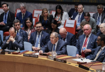
The resolution was approved in a recorded vote on Friday, with 107 countries voting in favour, marking an effort to address long-standing distortions in the way the world’s continents are visually represented.
The resolution notes that widely used map projections, particularly the Mercator projection, can significantly distort the apparent size of land areas located farther from the equator. As a result, Africa and other parts of the Global South can appear considerably smaller on maps than their actual geographical area.
Mercator Projection Under Scrutiny
Developed in the 16th century primarily for maritime navigation, the Mercator projection remains widely used in education, media, digital platforms and official materials. While useful for navigation, it does not accurately preserve the relative size of continents and countries.
The General Assembly said such distortions should not be viewed solely as a technical cartographic issue, arguing that they can also shape educational, cultural, geopolitical and economic perceptions of the relative size and importance of different regions.
It said greater accuracy in map representation could contribute to a better understanding of global geography and help address historical biases in the portrayal of continents.
Equal Earth Projection Highlighted
The resolution supports the use of the Equal Earth projection as one option for presenting continental land areas more accurately. It encourages UN member states, international organisations and other relevant institutions to consider equal-area projections where accurate representation of the size of continents is important.
The resolution also calls for greater cooperation among UN agencies, including UNESCO, the United Nations Development Programme (UNDP) and the UN Committee of Experts on Global Geospatial Information Management, together with the African Union and academic institutions.
The cooperation is intended to promote improved standards and practices in cartography, mapping and geospatial information.
Call for Greater Cartographic Awareness
The General Assembly further encouraged countries to incorporate greater awareness of cartographic principles into educational curricula and to raise awareness among schools, scientific institutions and media organisations about potential biases created by different map projections.
The draft resolution was submitted by a group of African countries in August as part of broader efforts to promote a more accurate representation of Africa in maps, educational materials and digital platforms.
The resolution, however, does not ban the Mercator projection or require countries to adopt the Equal Earth projection. Instead, it encourages the use of equal-area alternatives where an accurate comparison of continental and regional land sizes is important.
BY: The Times Union